Y Garn (Route 2) from Ogwen Cottage
Snowdonia/Eryri Walk
Nat Park - Snowdonia - Glyders Tryfan
County/Area - Gwynedd
Author - Peter Smyly
Length - 4.5 miles / 7.3 km Ascent - 2110 feet / 639 metres
Time - 4 hours 20 minutes Grade - mod/hard
Maps 

| Ordnance Survey Explorer OL17 | Sheet Map | 1:25k | BUY |
| Anquet OS Explorer OL17 | Digital Map | 1:25k | BUY |
| Ordnance Survey Landranger 115 | Sheet Map | 1:50k | BUY |
| Anquet OS Landranger 115 | Digital Map | 1:50k | BUY |
Walk Route Description

Click image to visit gallery of 3 images.
At 3,107 feet, Y Garn (The Cairn) is one of the Welsh peaks over three thousand feet, but this is a circular route which can be completed in half a day if need be (about five hours). If staying for a few days in Snowdonia (Eryri), it may therefore be considered a suitable walk for a last day before departing later in the afternoon, though the walk could also be combined with some of the other Glyderau summits if more time is available. There is a steep, well constructed path leading up from Llyn Idwal, but the route offers no real difficulties for anybody used to walking in mountains and therefore having the necessary stamina.
The Snowdonia (Eryri) walk starts at Idwal Cottage at the head of Llyn Ogwen. There is a youth hostel here with the mountains of Snowdonia on its doorstep. A well-constructed stone path leads, in less than a mile, to Llyn Idwal, a lake with the rock cleft known as the Devil's Kitchen at the far end. The Idwal Slabs, a well-known rock climbing spot, is passed by the route at the far end of the lake, on the left as seen from the outflow. It is quite possible that by this point, you will have seen people walking up this way with their rock climbing equipment and this may be a chance to see such activity at first hand. The first time I ever saw Llyn Idwal, the tops were covered in cloud after heavy rainfall, resulting in several swollen waterfalls coming down the mountainside above the lake as if coming from the clouds themselves.
At the outflow, follow the path ahead to the left of the lake and heading directly towards the Idwal Slabs. Having passed the lake, the path then goes to the right as it gains altitude, crosses a downward stream and continues on the other side before starting the upward climb to the left. The path doesn't go to the Devil's Kitchen itself, a massive cleft in the hillside, but follows a course to the left, of it emerging on to a relatively level area of ground where the small lake Llyn Y Cwn is situated. At this point, it's a case of onwards and upwards (to the right) though this is a bit of a dull slog to the top of Y Garn. Be prepared though for a dramatic view down to the right looking down on the two small lakes of Llyn Clyd - that is provided that the view is not blotted out by cloud as it was on the occasion of my visit in September 2005.
The downwards route can be followed by picking out a narrow path that leads gently at first down the shoulder to the right that overlooks Llyn Clyd to the east, but soon becomes much steeper and requires careful footwork as height is lost fairly rapidly. The route should present no difficulties from a route finding point of view as it follows the ridge down and rejoins Llyn Idwal near the outflow. To complete the walk, follow the path back down to Idwal Cottage.
Other walks nearby
| Walk 2650 | Tryfan, the Glyders & Y Garn | very hard | 8.0 miles |
| Walk 2820 | Carneddau traverse from Llyn Ogwen | mod/hard | 14.0 miles |
| Walk 1150 | The High Carneddau | hard | 10.0 miles |
| Walk 1215 | Tryfan & Llyn Ogwen from Ogwen Valley | mod/hard | 5.5 miles |
| Walk 3001 | Tryfan North Ridge from Ogwen Valley | hard | 3.5 miles |
| Walk 3026 | Tryfan & the Eastern Tops from Ogwen Valley | hard | 5.8 miles |
| Walk 1232 | Carnedd Llewelyn, Llyn Eigiau & Llyn Cowlyd | hard | 16.0 miles |
| Walk 2855 | Gallt yr Ogof & Braich y Ddeugwm | moderate | 4.0 miles |
| Walk 3056 | Pen yr Helgi Du from Ogwen Valley | moderate | 5.5 miles |
| Walk 1074 | The Glyders Traverse | very hard | 12.0 miles |
Recommended Books & eBooks
Great Mountain Days in Snowdonia
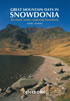 Inspirational guidebook to 40 great mountain day walks and scrambles in Snowdonia. Inspirational routes for all abilities across the National Park with routes up Snowdon and Moel Eilio, the Glyderau, the Carneddau, Eifionydd, Siabod and the Moelwynion, Rhinogydd (the Harlech Dome), Migneint and the Arans and Cadair Idris and the Tarrens.
More information
Mountain Walking in Snowdonia
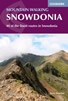 Guidebook to 40 of Snowdonia's best day walks, with routes up Snowdon and Tryfan, including the Snowdon Horseshoe, Cadair Idris, Y Garn and The Rhinogs. The routes range from Grade 1 scrambles like Crib Goch or Bristly Ridge, to riverside and forest walks. Includes details of a 2-day traverse of all 15 of Snowdonia's 3000ft peaks.
More information
Messaging & Social Media
Message Walking Britain and follow the latest news.

Mountain Weather
Stay safe on the mountains with detailed weather forecasts - for iOS devices or for Android devices.