The Glyders Traverse from Capel Curig
Snowdonia/Eryri Walk
Nat Park - Snowdonia - Glyders Tryfan
County/Area - Gwynedd & Conwy
Author - Peter Smyly
Length - 12.0 miles / 19.5 km Ascent - 4800 feet / 1455 metres
Time - 10 hours 50 minutes Grade - very hard
Maps 

| Ordnance Survey Explorer OL17 | Sheet Map | 1:25k | BUY |
| Anquet OS Explorer OL17 | Digital Map | 1:25k | BUY |
| Ordnance Survey Landranger 115 | Sheet Map | 1:50k | BUY |
| Anquet OS Landranger 115 | Digital Map | 1:50k | BUY |
Walk Route Description

Click image to visit gallery of 12 images.
As the title may suggest, this is a traverse of the main ridge of the Glyderau range in Snowdonia (Eryri). Tryfan is the only main peak excluded, although particularly fit walkers with time and energy to spare could also include it as an "out and back", bearing in mind the additional cumulative ascent. Even without including Tryfan, this is a big walk likely to span eight hours or more. In common with Tryfan, Elidir Fawr is also an outlying Glyder and this is included as part of the route as an "out and back". The latter half of the walk from Glyder Fach to Capel Curig is relatively dull. Therefore, one alternative route option would be to park at Idwal Cottage, and then proceed with this route, as far as Glyder Fach, but then descend to Idwal Cottage via the Miner's Track, or Bristly Ridge. This route choice would also allow time to include Tryfan without any need to return to the main ridge.
The linear nature of this Snowdonia (Eryri) walk means that if two cars are not available, a viable alternative is to park at Capel Curig and use a local bus. There is a car park off a road behind the general store and the Snowdon Sherpa bus can be taken towards Bethesda, one option being to alight at Ty'n-y-maes where this walk route begins.
On a clear day, this is one of the finest walks in Wales and would serve as an excellent introduction to the main peaks and some of the lakes of Snowdonia (Eryri). Not only are four of the 3,000 feet plus peaks included, the other eleven are all clearly seen along with various other peaks including the Moel Hebog range, the Nantlle Ridge, the Moel Eilio hills and some of the lesser known Carnedds - Pen Llithrig y Wrach, Pen yr Helgi Du, Creigiau Gleision, Craig Wen and Crimpiau. The sea is also seen at different points on the walk in the distance in the form of Conwy Bay to the north and Caernarfon Bay to the west.
The route passes two llyns (lakes), Llyn y Cwn beneath the rugged rocky slopes of Glyder Fawr and Llyn Caseg-fraith, best known for its appearance in picture postcards as a foreground to Tryfan. Several other lakes of varying sizes are also looked down on:
Marchlyn Mawr (Reservoir) Marchlyn Bach (Reservoir) Llyn Cywion in Cwn Cywion Llyn Ogwen Llyn Idwal in the Cwm Idwal National Nature Reserve Llyn Clyd in Cwm Clyd Llyn Bochlwyd Llyn Cwmffynnon Llyn Lockwood Llynnau Mymbyr
This is not a walk to be undertaken lightly and should only be attempted by fit and competent walkers. Glyder Fawr marks the approximate half way point, by which time you will already have done five ascents of varying steepness:
1) The initial climb up on to the main ridge. 2) The climb up Carnedd y Filiast. 3) The ascent of Elidir Fawr 4) The path up Y Garn 5) The hardest climb of the whole walk, in my opinion, the scree-like path up Glyder Fawr.
The second half of the walk is easier with fewer, and easier, ascents along with more gentle terrain, sometimes boggy. In terms of terrain, you can expect a mixture that includes bog, peat and wet ground underfoot, especially in the last few miles, steep rocky paths, some clambering over rocks and boulders and some grassy ridges.
From Ty'n-y-maes, follow a minor road that crosses a bridge over the Afon Ogwen. Unfortunately, there is not an obvious path leading up on to the ridge and therefore you are largely required to use your own initiative to find a way up. Carnedd y Filiast is prominent on the ridge above and one option is to leave the road to go through a wooden gate to head for Cwm Ceunant. Aim for the right side of the stream where there is a semblance of a path higher up but generally, any paths around here are at best intermittent, at worst non-existent. However, the right general direction is clear enough in good visibility. Either way, it is a choice between ascending to the left or right of the steep, rocky Cwm Ceunant. The shoulder to the right is less steep and has more of a path, if you can find it. The rounded bulk of Carnedd y Filiast towers above to the left and this is the first objective once the ridge has been gained, after descending to the col. A "route one" approach may be preferred up a steep slope with loose stones. Any attempt to skirt round to the right to reach the top will result in a certain amount of clambering over rocks. The top, which only comes into view once you are almost upon it, is marked by a wind shelter and there is a fine view across to the high peaks of the Carneddau on the other side of the Nant Ffrancon valley. Carnedd Dafydd appears pyramid-shaped, Pen Yr Ole Wen shows its rugged steep slopes of loose rocks, Yr Elen and Carnedd Llewellyn appear behind and the three outlying 3,000 foot plus peaks, Foel Grach, Carnedd Uchaf and Foel- fras appear as little more than minor bumps along the ridge which in reality is what they are.
After the toil involved in walking up thus far, the next section, by way of contrast, is striding out terrain as the route crosses a wooden stile over a dry stone wall and it quickly leads to the wind shelter atop the next summit, Mynydd Perfedd. A wooden stile over a fence to the right leads to a path which ascends the outlier, Elidir Fawr, seen ahead in the shape of a pyramid with vertically striated rock formations.
With the big reservoir of Marchlyn Mawr seen impressively below to the right, the way up Elidir Fawr, goes up Bwlch y Marchlyn and passes through three basic stages - a fairly narrow rocky ridge, a grassy shoulder, then the final ascent across stones and rocks to another wind shelter at the top. Fittingly, for a Glyder, the top features a clitter of stones. The views are far and wide with much of the remainder of the route clearly seen including Y Garn, Tryfan, Glyder Fawr and Glyder Fach. Return back down the path which skirts round to follow the main ridge, thus avoiding any need to return to the top of Mynydd Perfedd. The top of Foel-goch is an optional extra to the left but the main path bypasses it to the right.
The next summit, Y Garn, is reached by way of a path that follows a sinuous route up a steep gravely slope in its latter stages. Looking back at Eldiir Fawr, you can tell that you are now at a similar height or higher, a reminder that Y Garn also tops 3,000 feet. As the ridge levels out, the summit cairn is seen ahead and to the left, a cluster of lakes are seen way below,, the two lakes of Llyn Clyd, Llyn Idwal, Llyn Ogwen and also a glimpse of Llyn Bochlwyd. The first time I walked up Y Garn, eight years previously, I did not seen anything of this view due to mist.
A well-worn path leads down from Y Garn with the next objective, Glyder Fawr clearly in view with Llyn y Cwn at it's foot. Once the tarn has been passed, next begins the most arduous stretch of the whole walk, a matter which, in terms of energy levels, may well be compounded by the fact of having already covered so much steep, rocky ground already. At least the scree-like path, although steep, tends not to give way under one's feet and once this stretch has been passed, easier gradients across a clitter of stones lead to the summit. Glyder Fawr is higher than Scafell Pike, the highest peak in England but, there is no summit cairn and you are not likely to encounter any crowds up here. Instead, the highest point is an outcrop of spiky rocks, of which there are quite a few in the vicinity.
I doubt if the name Bwlch y Ddwy-Glyder is one that readily comes to mind among those walking the Glyders. This is the name of the col between Glyder Fawr and Glyder Fach, and is the section passed next as the route leads to Glyder Fach and the spiky rock formations of the Castle of the Winds. The top of Glyder Fach can be bypassed by following round to the right if time is short; this route does involve a certain amount of clambering over rocks
A path leads down from Glyder Fach with Tryfan dominating the view to the left, backed by the Carneddau, as it heads towards Llyn Caseg-fraith and its satellite pools. Although the path is intermittent in places, the general direction is obvious as you cross over two minor tops, Y Foel Goch and Cefn y Capel. Capel Curig is still around five kilometres away and this stretch may seem interminably long and something of an anti-climax. It does, however, offer fine views of some of the Carnedds to the left and Moel Siabod to the right. Capel Curig remains out of sight until the very latter stages of the ridge have been crossed and the descent to the village begins.
Other walks nearby
| Walk 2558 | Carnedd Dafydd & Pen yr Ole Wen from Bethesda | mod/hard | 8.0 miles |
| Walk 3051 | Yr Elen from Gerlan | hard | 6.5 miles |
| Walk 3052 | Yr Elen & Carnedd Dafydd from Gerlan | hard | 9.0 miles |
| Walk 2115 | Yr Elen, Carnedd Llewellyn & Carnedd Dafydd | hard | 9.5 miles |
| Walk 1453 | Elidir Fawr, Mynydd Perfedd & Marchlyn Mawr reservoir | moderate | 6.0 miles |
| Walk 2833 | Moel Faban, Gyrn & Moel Wnion from Rachub | easy/mod | 5.0 miles |
| Walk 1315 | Drosgl and Gyrn Wigau from Rachub | moderate | 7.5 miles |
| Walk 1088 | Glyder Ridge traverse | hard | 5.5 miles |
| Walk 1186 | Y Garn | mod/hard | 4.5 miles |
| Walk 3019 | Y Garn & Carnedd y Filiast Ogwen Cottage | hard | 8.5 miles |
Recommended Books & eBooks
Great Mountain Days in Snowdonia
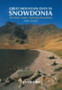 Inspirational guidebook to 40 great mountain day walks and scrambles in Snowdonia. Inspirational routes for all abilities across the National Park with routes up Snowdon and Moel Eilio, the Glyderau, the Carneddau, Eifionydd, Siabod and the Moelwynion, Rhinogydd (the Harlech Dome), Migneint and the Arans and Cadair Idris and the Tarrens.
More information
Snowdonia: 30 Low-level and easy walks - South
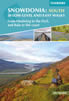 Guidebook describing 30 walks in Snowdonia, Wales. Routes are mostly low level and on clear paths and showcase the region's beautiful scenery and rich history and culture. Part of a 2-volume set, this southern volume includes Trawsfynydd, Bala, Dolgellau, Machynlleth, the Harlech Coast and the valleys of the Mawddach and Dyfi.
More information
Messaging & Social Media
Message Walking Britain and follow the latest news.

Mountain Weather
Stay safe on the mountains with detailed weather forecasts - for iOS devices or for Android devices.