Caldey Island Circular
Pembrokeshire Coast Walk
Nat Park - Pembrokeshire Coast
County/Area - Pembrokeshire
Author - Lou Johnson
Length - 3.0 miles / 4.9 km Ascent - 400 feet / 121 metres
Time - 1 hours 50 minutes Grade - easy
Maps 

| Ordnance Survey Explorer OL36 | Sheet Map | 1:25k | BUY |
| Anquet OS Explorer OL36 | Digital Map | 1:25k | BUY |
Walk Route Description
Click image to see photo description.
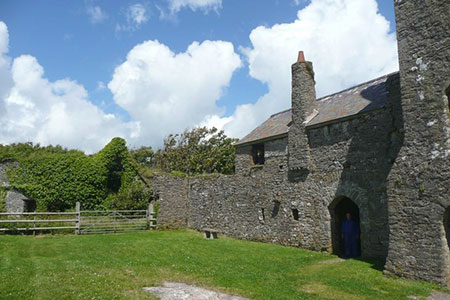
This circular walk around Caldey Island in Pembrokeshire offers a short but interesting half day excursion. Caldey Island lies about a kilometre off the coast from Tenby. The ferry service normally operates every fifteen minutes from Easter through to late September. The island has a rugged coast and its tourist attractions include the 13th-century church of St Illtyd, a lighthouse built in 1828, a monastery and locally produced perfume and chocolate.
From the jetty (grid ref. SS137969) follow the lane into the centre of the village and continue south to reach the end of the lane and the coast. The lighthouse and picnic tables are on your left. To your right is the OS trig point (56 metres above sea level). To continue the walk, follow the coast path past the OS trig point (sea on your left). The path follows the wall on your right and loops to the right to reach Red Berry Bay. Continue following the path around Red Berry Bay to a wall corner from where the path loops to the left across grass to run alongside another wall (grid ref. SS134962).
Follow the wall to another corner and turn right with the wall still on your right. After 25o metres turn right through a gap and follow the path alongside wall to reach Sandtop Bay with its excellent sandy beach. The path angles right and then bears left across grass to reach a pond (often dry). Turn right through the wall and follow the path with the wall on your right to reach Caldey Priory and the chocolate factory (grid ref. SS140962). To return to the jetty, follow the path from the Priory through woodland to reach the lane through the village. Turn left back to the jetty.
Other walks nearby
| Walk 3363 | Swanlake Bay from Manorbier | easy/mod | 4.8 miles |
| Walk 1209 | Saundersfoot & Tenby | easy/mod | 4.5 miles |
| Walk 3364 | The Stackpole Estate from Stackpole Quay | easy | 5.0 miles |
| Walk 3369 | Pendine to Amroth Coast Path | moderate | 5.7 miles |
| Walk 3366 | Bosherston Lily Ponds | easy | 3.4 miles |
| Walk 3365 | Bosherston Lily Ponds, Broad Haven & St. Govan's Chapel | easy/mod | 5.0 miles |
| Walk 3495 | St. Govan's Chapel, Bosherston & Elegug Stacks | moderate | 9.6 miles |
| Walk 3498 | Freshwater West & Angle | moderate | 8.7 miles |
| Walk 1880 | Ferryside & Llansaint | easy/mod | 5.0 miles |
| Walk 3497 | Angle Peninsula | easy | 3.7 miles |
Recommended Books & eBooks
The Wales Coast Path
 A single guidebook to walking the whole Wales Coast Path - 1400km (870 miles) the length of Wales from Chester to Chepstow, including Anglesey, described in 57 stages. The route passes through the Snowdonia and Pembrokeshire National Parks and many AONBs and can be linked with the Offa's Dyke Path for a complete circuit of Wales.
More information
Messaging & Social Media
Message Walking Britain and follow the latest news.

Mountain Weather
Stay safe on the mountains with detailed weather forecasts - for iOS devices or for Android devices.