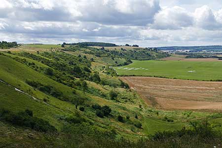
Dunstable Downs & Totternhoe from Robertson Corner
Chilterns Walk
Region - Chilterns
County/Area - Bedfordshire
Author - Tony Kellett
Length - 8.8 miles / 14.3 km Ascent - 750 feet / 227 metres
Time - 5 hours 10 minutes Grade - easy/mod
Maps 

| Ordnance Survey Explorer 181 | Sheet Map | 1:25k | BUY |
| Anquet OS Explorer 181 | Digital Map | 1:25k | BUY |
| Ordnance Survey Explorer 182 | Sheet Map | 1:25k | BUY |
| Anquet OS Explorer 182 | Digital Map | 1:25k | BUY |
Walk Route Description
Click image to see photo description.
From the car park west of Robertson Corner (grid ref. TL008197) head north and follow the waymarked path (the Icknield Way Trail) along the top of the slope to the Five Knolls tumuli. Here walk downhill to join West Street, which runs along the line of the Icknield Way. Cross West Street on to the Green Lane opposite. This is known as Drovers Way and is followed by the Chiltern Way as well as the Icknield Way Trail.
You soon get a fine view of Ivinghoe Beacon in the distance on your left. The view back to the Downs includes the Five Knolls you have recently visited. Continue along the Green lane, ignoring the first Green Lane on the left to reach a cross roads of Green Lanes (grid ref. SP998221).
Turn right and follow the signed bridleway, ignoring the footpath off to the right, and continue onto a disused railway (grid ref. SP996227). Turn left (west) along the old railway and walk for just over a mile. Just before you reach the A505 main road (grid ref. SP978229) turn left down a green lane heading south-east. At the first junction (grid ref. SP979226) turn right. In 200 metres turn left down a signed footpath. This leads to a track at the foot of Castle Hill (grid ref. SP977223).
Turn left along the track and follow it around the base of Castle Hill (on your right) ignoring footpaths on the right which lead onto the hill. Reaching a junction (grid ref. SP984218) bear left and follow the continuing track to reach the road through Totternhoe village (grid ref. SP986214). Turn left along the road and follow it as it turns south passing a junction with Dunstable Road on the left. At the next junction turn left up Well Head Road. Follow this as far as the B489 (Icknield Way) near Well Head.
Carefully cross the B489 and follow the bridleway opposite, with the London Gliding Club on the right, and continue to the base of the Downs. At the end of the bridleway (grid ref. TL005202), turn right and follow the footpath along the bottom of the slope. Continue following the waymarked path along the bottom of the hill. Reaching a kissing gate, you can choose to follow the bridleway on the right or continue through the kissing gate and follow the lower path.
Before reaching the road (grid ref. SP997186), turn left and climb up hill parallel to the road. Reaching the top, near the Bison Hill car park, follow the bridleway that leads to the left, entering a pasture via a gate. Contour across this field enjoying views over the surrounding countryside, including the Vale of Aylesbury. The bridleway goes through another gate where you continue straight ahead to return to the start.
Other walks nearby
| Walk 3409 | The Three Counties Tops | mod/hard | 17.0 miles |
| Walk 1833 | Great Gaddesden from Jockey End | easy | 5.2 miles |
| Walk 1999 | The Chilterns above Tring | moderate | 12.0 miles |
| Walk 2399 | The Chilterns above Tring (short version) | easy/mod | 8.0 miles |
| Walk 2064 | Ivinghoe Beacon from the Ashridge Estate | easy/mod | 6.5 miles |
| Walk 1007 | The Ashridge Estate circular | easy/mod | 6.0 miles |
| Walk 3025 | Ashridge Estate Circular | easy | 4.5 miles |
| Walk 2795 | Circular from Great Gaddesden to Little Gaddessden | easy/mod | 7.5 miles |
| Walk 2999 | Mansions & Parklands from Great Gaddesden | easy/mod | 7.0 miles |
| Walk 1943 | Cheddington to Tring via Marsworth | easy/mod | 8.0 miles |
Recommended Books & eBooks
No suggestions for this area.Messaging & Social Media
Message Walking Britain and follow the latest news.

Mountain Weather
Stay safe on the mountains with detailed weather forecasts - for iOS devices or for Android devices.