Alston & Garrigill
North Pennines Walk
Region - North Pennines
County/Area - Cumbria
Author - Lou Johnson
Length - 8.7 miles / 14.1 km Ascent - 850 feet / 258 metres
Time - 5 hours 10 minutes Grade - easy/mod
Maps 

| Ordnance Survey Explorer OL31 | Sheet Map | 1:25k | BUY |
| Anquet OS Explorer OL31 | Digital Map | 1:25k | BUY |
Walk Route Description
Click image to see photo description.
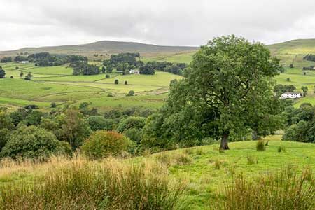
A lovely walk from the market town of Alston that explores the River South Tyne valley south to the village of Garrigill. The outward route follows the Pennine Way and Pennine Journey long distance trails which are signed. From Garrigill the walk follows the east side of the river with one section along a road before using paths and tracks to return to Alston.
The tart is the Tourist Information Centre in Alston (grid ref. NY718465). There is on street parking nearby. To start the walk, continue downhill to a T-junction and turn left to Penrith (A686). After 300 metres turn left (signed Youth Hostel) and bear right at the next junction (again signed Youth Hostel) to join the Pennine Way which is followed for 2.5 kilometres south to Bleagate Farm (grid ref. NY717437). Reaching the farm, the Pennine Way turns right to the River South Tyne.
Turn left and continue along the Pennine Way and after just over a kilometre cross the footbridge to the other side of the river, which is followed to a lane on the outskirts of Garrigill. Turn left along the road and continue to the village green in Garrigill (grid ref. NY745416). Keep to the left side of the green and continue to a road junction. Turn left (signed to Alston) past the George and Dragon Inn. Cross the river and follow the road round to the left. Stay on the road for 2.5 kilometres to a junction with the B6277, enjoying some fine views across the valley on your left.
Keep ahead at the junction and continue towards Alston. Take the first lane on the left (No through road) and descend into the valley with further fine views of the area. Nearing the bottom of the hill the lane veers right and becomes less well maintained. Turn left at the fingerpost (grid ref. NY722435). After a few metres leave the track and follow the path alongside a wall (on your right). Enter the next field you meet the Pennine Way. Do not follow the PW but turn right through the wall and keep the wall on your right to reach the access drive to Bleagate Farm. Turn right along the access track and continue north to a three-way junction (grid ref. NY720444).
Bear left and take the first footpath on the right. The path continues across two fields to enter woodland. Cross the footbridge over Nattrass Gill and exit the trees. The path crosses fields to a lane and house at Annat Walls. Follow the lane for a kilometre to reach some bungalows on the outskirts of Alston (grid ref. NY720460). Turn left down a no through road. Just past the last bungalow on the right, turn right onto a path that leads you to the A689. Turn left and continue back into Alston.
Other walks nearby
| Walk 1084 | Garrigill, Alston & Nenthead | moderate | 13.1 miles |
| Walk 3758 | Tynehead and Ashgill Force from near Garrigill | easy/mod | 8.2 miles |
| Walk 1987 | Allendale Town Circular | easy/mod | 6.6 miles |
| Walk 1659 | Race Head & Sedling Rake from Wearhead | easy/mod | 6.0 miles |
| Walk 3071 | Cross Fell & Great Dun Fell from Kirkland | mod/hard | 12.0 miles |
| Walk 3274 | Cronkley Scar & Cauldron Snout | moderate | 8.0 miles |
| Walk 1683 | High Cup Nick & Cow Green Reservoir | moderate | 12.8 miles |
| Walk 3336 | Cauldron Snout | easy | 3.6 miles |
| Walk 3593 | Meldon Hill from Cow Green Reservoir | moderate | 9.2 miles |
| Walk 1715 | Dufton Pike & Dufton | easy | 5.0 miles |
Recommended Books & eBooks
Great Mountain Days in the Pennines
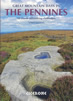 An inspirational guidebook to 50 classic walks on the rolling Pennine landscape. The graded routes, between 6 and 13 miles in length, cover classic Pennine fells and moorland such as Whernside, Ilkley Moor and Pendle Hill; exploring the North and South Pennines, Yorkshire Dales, Howgills and Dark Peak. Many routes are also suited to fell running.
More information
Walking the Lake District Fells - Keswick
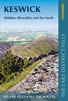 Part of the Walking the Lake District Fells series, this guidebook covers a wide range of routes to 30 Lakeland summits that can be climbed from Keswick, Whinlatter, Bassenthwaite, Caldbeck, Mungrisdale and Threlkeld, with highlights including Skiddaw and Blencathra. Includes suggestions for longer ridge routes.
More information
Messaging & Social Media
Message Walking Britain and follow the latest news.

Mountain Weather
Stay safe on the mountains with detailed weather forecasts - for iOS devices or for Android devices.