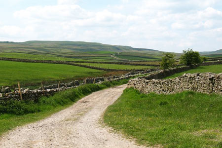
Haw Lane & Aysgarth Moor from Aysgarth
Yorkshire Dales Walk
Nat Park - Yorkshire Dales - Wensleydale
County/Area - North Yorkshire
Author - Lou Johnson
Length - 6.3 miles / 10.2 km Ascent - 600 feet / 182 metres
Time - 3 hours 50 minutes Grade - easy/mod
Maps 

| Ordnance Survey Explorer OL30 | Sheet Map | 1:25k | BUY |
| Anquet OS Explorer OL30 | Digital Map | 1:25k | BUY |
| Ordnance Survey Landranger 98 | Sheet Map | 1:50k | BUY |
| Anquet OS Landranger 98 | Digital Map | 1:50k | BUY |
Walk Route Description
Click image to see photo description.
Wensleydale is one of the finest of the Yorkshire Dales and this walk starts from Aysgarth a pretty stone built village on the banks of the River Ure. The route follows paths and moorland tracks for much of the way and offers grand views of the surrounding fells. Aysgarth village on the A684 from Hawes to Leyburn (grid ref. SE003884) has limited parking opportunities and you are asked to park with consideration.
After parking, walk towards the eastern end of the village along the A684 towards Leyburn. Where the main road turns sharp left, continue straight ahead along a lane to Thoralby. Almost immediately turn right down a signed track. Reaching a T-junction, turn left following a track to the end of the first field. The onward path goes half right and leads across fields to reach Folly Lane (grid ref. SD994874). Go left here and continue to follow this track south to Haw Lane (grid ref. SD995868). Bear right into Haw Lane and follow for just over one and a half miles until Haw Lane has become Stake Road.
Reaching the first footpath on the right (grid ref. SD970859), turn right at the cairn on your right. Descend slightly to cross Gayle Ing Beck and continue following the path in a north-easterly direction across Haw Head. Maintaining this direction will lead you to the end of Flout Moor Lane which is contained by walls on either side.
Follow Flout Moor Lane as it crosses Aysgarth Moor and continues in an easterly direction back towards Aysgarth. Reaching the junction with Folly lane (grid ref. SD994878) keep straight ahead and follow the walled lane as it turns sharp left and leads up to a tarmac lane (grid ref. SD996881). Turn right along this lane and you will soon be back in Aysgarth village.
Other walks nearby
| Walk 1055 | Penhill & West Burton | moderate | 10.0 miles |
| Walk 3384 | Aysgarth Falls and Caperby | easy | 4.0 miles |
| Walk 1694 | Nappa Hall & Whitfield Gill Force | easy/mod | 6.0 miles |
| Walk 3333 | Redmire Force & the Templar's Chapel from West Witton | easy/mod | 6.7 miles |
| Walk 2822 | Aysgarth & Castle Bolton | mod/hard | 14.5 miles |
| Walk 3524 | Semer Water and Cam High Road from Bainbridge | easy/mod | 5.7 miles |
| Walk 2265 | Semer Water, Stalling Busk & Marsett | easy | 4.0 miles |
| Walk 2190 | Calver Hill & Reeth Low Moor | easy/mod | 6.0 miles |
| Walk 1056 | Gunnerside & Surrender Bridge | moderate | 10.3 miles |
| Walk 1197 | Gunnerside & Swinner Gills | moderate | 8.5 miles |
Recommended Books & eBooks
Trail and Fell Running in the Yorkshire Dales
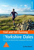 Guidebook to 40 of the best trail and fell runs in the Yorkshire Dales National Park. Ranging from 5 to 24 miles, the graded runs start from bases such as Ribblehead, Dent, Sedbergh, Malham and Grassington and take in the region's diverse delights, from castles and waterfalls to iconic mountains such as Whernside, Ingleborough and Pen Y Ghent.
More information
Walking in the Yorkshire Dales: South and West
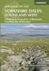 Part of a two-book set, this guidebook describes 44 walks in the southern and western Yorkshire Dales, including the famous 23 mile Three Peaks circuit over Pen-y-Ghent, Whernside and Ingleborough. The other, mostly circular routes of 3½ to 13 miles cover the scenic region between Sedbergh, Kirkby Lonsdale, Settle, Skipton and Grassington.
More information
Messaging & Social Media
Message Walking Britain and follow the latest news.

Mountain Weather
Stay safe on the mountains with detailed weather forecasts - for iOS devices or for Android devices.