Aldeburgh and Thorpeness Circular
Suffolk Walk
County/Area - Suffolk
Author - Lou Johnson
Length - 8.5 miles / 13.8 km Ascent - 50 feet / 15 metres
Time - 4 hours 20 minutes Grade - easy/mod
Maps 

| Ordnance Survey Explorer 212 | Sheet Map | 1:25k | BUY |
| Anquet OS Explorer 212 | Digital Map | 1:25k | BUY |
| Ordnance Survey Landranger 156 | Sheet Map | 1:50k | BUY |
| Anquet OS Landranger 156 | Digital Map | 1:50k | BUY |
Walk Route Description
Click image to see photo description.
This pleasant walk explores the area north of Aldeburgh as far as Thorpe Ness. The walking is easy and the immediate surroundings pleasant . The route uses a section of the Suffolk Coast and Heaths Path, details of which can be found on this website.
The start is the car park at the southern end of Aldeburgh at Fort Green (grid ref. TM464560). In addition there are other options for parking nearer the centre. After parking walk north along the sea front with the sea on your right. After 1.5 miles you join the Suffolk Coast and Heaths Path for a further 2 miles passing through the village of Thorpeness on the way. Reaching Dower House, take the next left turn after the house (grid ref. TM475616). Continue along this byway as it bears left. Take the next byway on your left (grid ref. TM473617) and continue across a ?crossroads? to the next junction (grid ref TM468611) where you bear left. Continue ahead across Thorpeness Common into the village of Thorpeness.
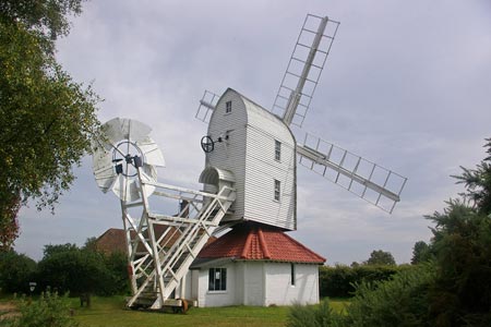
Continue south along the road named 'the Sanctuary'. Turn right into the Haven with ?the Meare? on your left. Go left into Uplands Road passing the fine windmill as you walk west along the northern shores of the Meare. Reaching a junction of paths (grid ref. TM464599) bear left. Continue ahead until you reach the old railway line (grid ref. TM462598).
Turn left down the route of the old railway following the clear path for 1.5 miles until you reach a signed footpath on your left (grid ref. TM460574). Go left here and continue through the Caravan site on the marked path to reach a junction of paths (grid ref.TM463573). Go straight across and continue ahead through the churchyard onto Victoria Road. Turn left towards the sea front and then right to return to the Fort Green carpark.
Other walks nearby
| Walk 2428 | The Rivers Ore & Alde from Orford | easy/mod | 11.0 miles |
| Walk 1775 | Walberswick Circular | easy | 4.5 miles |
| Walk 2014 | Southwold | easy | 4.0 miles |
| Walk 3603 | Blythburgh from Wenhaston | easy | 5.0 miles |
| Walk 3267 | Ramsholt, River Deben and Shottisham Circular | easy/mod | 9.2 miles |
| Walk 1648 | Church End & Erwarton from Shotley Gate | easy | 6.0 miles |
| Walk 2017 | Pin Mill to Shotley Gate | easy | 5.5 miles |
| Walk 1639 | Erwarton, Church End & River Orwell from Pin Mill | easy/mod | 8.0 miles |
| Walk 3642 | Shotley Gate & Ewarton from Chelmondiston | moderate | 10.6 miles |
| Walk 2374 | Freston Circular | easy/mod | 6.6 miles |
Recommended Books & eBooks
Suffolk Coast and Heath Walks
 Guidebook to three long-distance routes exploring the varied landscapes of the Suffolk Coast and Heaths AONB. The Suffolk Coast Path covers 55 to 60 miles from Lowestoft to Felixstowe. The Stour and Orwell Walk is 40 miles from Felixstowe to Cattawade near Manningtree, while the Sandlings Walk is 59 miles from Ipswich to Southwold.
More information
Messaging & Social Media
Message Walking Britain and follow the latest news.

Mountain Weather
Stay safe on the mountains with detailed weather forecasts - for iOS devices or for Android devices.