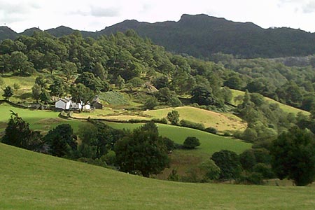
Colwith Force and Skelwith Force from Elterwater
Lake District Walk
Nat Park - Lake District - Lake District Central Fells
County/Area - Cumbria
Author - Peter Smyly
Length - 4.8 miles / 7.8 km Ascent - 650 feet / 197 metres
Time - 3 hours 0 minutes Grade - easy/mod
Maps 

| Ordnance Survey Explorer OL7 | Sheet Map | 1:25k | BUY |
| Anquet OS Explorer OL7 | Digital Map | 1:25k | BUY |
| Ordnance Survey Landranger 90 | Sheet Map | 1:50k | BUY |
| Anquet OS Landranger 90 | Digital Map | 1:50k | BUY |
Walk Route Description
Click image to visit gallery of 6 images.
This circular Lake District walk explores part of the Langdale and Elterwater area of Lakeland. While no tops are included, two waterfalls provide picturesque landmarks, Colwith Force and Skelwith Force. The latter is not clearly seen from the footpath on the west side of the River Brathay, but to see it properly requires only a minor detour on the other side of the river.
Starting outside the Britannia Inn at Elterwater village, cross the bridge over the river and follow the narrow tarmac road due south-west, then south, as it goes past the Youth Hostel on the right, though it was due for closure at the time of writing (August 2013). Pass the Eltermere Hotel on the left and leave the road to follow a bridleway uphill on the right, due south-west. As the track gradually turns left, a view opens out, also on the left, with a distant glimpse of Wansfell Pike.
The path passes another path coming in from woodland on the right as the landscape opens out to the left. Take a left turn along a signed public footpath to follow a route down to the farm at Wilson Place in half a mile with the whaleback shape of Wetherlam especially apparent ahead. On approaching Wilson Place, the knobbly outline of the lower height of Holme Fell forms the skyline, seen beyond the track to Stang End.
Just beyond Wilson Place, take care with any oncoming traffic as you follow the narrow tarmac road left for about fifty yards, then take the next public footpath to the right down a grassy field and across a narrow wooden footbridge over a stream, the outflow of Little Langdale Tarn, to continue up to Stang End. The track ahead to the right leads south to Hodge Close but continue left along the narrow lane to the next farm at High Park where the route leads downhill to the left to reach woodland and Colwith Force is just a few minutes walk away. A narrow path skirts round to the left to reveal a series of mini cascades in addition to the principal fall of water seen from the main path.
The path continues through woodland up a series of steep steps before descending to a road. Turn right here and then take the next public footpath on the left, the Cumbria Way, which you follow past Park Farm and Park House. Follow it all the way back to Elterwater village, passing Skelwith Force on the right before a footbridge. The view across the lake of Elterwater towards the Langdale Pikes, just before Rob Rash Woods, is quite possibly the best shoreline view of the lake which otherwise tends to remain elusively hidden.
Other walks nearby
| Walk 2715 | Skelwith Bridge & Loughrigg | easy/mod | 5.5 miles |
| Walk 1684 | Lingmoor Fell & Langdale | easy/mod | 7.0 miles |
| Walk 1823 | Fairfield Horseshoe & Loughrigg from High Close | mod/hard | 14.0 miles |
| Walk 1134 | Wetherlam and The Carrs | mod/hard | 10.8 miles |
| Walk 2270 | Tilberthwaite and Holme Fell Little Langdale | easy/mod | 5.5 miles |
| Walk 3697 | Loughrigg Fell from Skelwith Bridge | easy/mod | 4.5 miles |
| Walk 1154 | Between Grasmere and Langdale | moderate | 9.5 miles |
| Walk 1472 | Alcock Tarn & Rydal Water | easy/mod | 7.0 miles |
| Walk 1565 | Rydal Water & Grasmere circular | easy/mod | 6.0 miles |
| Walk 1682 | Rydal Water & Grasmere | easy/mod | 5.5 miles |
Recommended Books & eBooks
Lake District: Low Level and Lake Walks
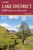 This guidebook describes 30 of the best low-level walks in the Lake District. From delightful wooded glades and sparkling tarns, to waterfalls and glacier-carved valleys towered over by craggy mountains. The walks described aim to seek out the best walking that the lower areas of the Lake District have to offer.
More information
Hadrian's Wall Path
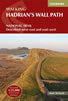 Hadrians Wall Path guidebook to walk the 84 mile National Trail. Described in both directions, the main description is west to east between Bowness-on-Solway and Wallsend, Newcastle, with extensions to Maryport and South Shields. With extensive historical information related to this World Heritage site and separate 1:25,000 OS map booklet included.
More information
Messaging & Social Media
Message Walking Britain and follow the latest news.

Mountain Weather
Stay safe on the mountains with detailed weather forecasts - for iOS devices or for Android devices.