Books and Maps
This section is designed to include a summary of recently published books and mapping useful for all walkers in the British Isles. Links are provided so you can obtain further detailed information and complete on-line purchases.
Cicerone Press 
An excellent range of guides and maps produced by a publisher dedicated to outdoor activities including walking, scrambling and cycling. The following are a selection from their exhaustive catalogue.
Great Mountain Days in Snowdonia
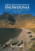 Inspirational guidebook to 40 great mountain day walks and scrambles in Snowdonia. Inspirational routes for all abilities across the National Park with routes up Snowdon and Moel Eilio, the Glyderau, the Carneddau, Eifionydd, Siabod and the Moelwynion, Rhinogydd (the Harlech Dome), Migneint and the Arans and Cadair Idris and the Tarrens.
More information
Walking in County Durham
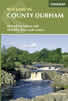 Guidebook offering detailed descriptions of 40 day walks, plus 10 traffic-free cycle routes along old railway trackbeds. Together they cover 450 miles and spread all over County Durham to show the region's history and natural wonders. The terrain covered ranges from field paths to open moorlands, from the North Sea to the high Pennines.
More information
Walking Hampshire's Test Way
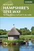 Guidebook to walking the 71km (44 mile) Test Way in Hampshire from high on the chalk downs of Inkpen Beacon to the Eling Tide Mill near Southampton Water. Following the beautiful, crystal clear River Test, it passes picturesque villages and fascinating historic sites. Also includes 15 day walks to explore this lovely part of pastoral England.
More information
The Cleveland Way Map Booklet
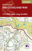 Map booklet of the Cleveland Way National Trail, a 177km (110 mile) walk around the North York Moors National Park. This booklet is included with the Cicerone guidebook to the Cleveland Way and the Yorkshire Wolds Way, and shows the full route of the Cleveland Way on Ordnance Survey 1:25,000 maps.
More information
Hadrian's Wall Path
 Hadrians Wall Path guidebook to walk the 84 mile National Trail. Described in both directions, the main description is west to east between Bowness-on-Solway and Wallsend, Newcastle, with extensions to Maryport and South Shields. With extensive historical information related to this World Heritage site and separate 1:25,000 OS map booklet included.
More information
Suffolk Coast and Heath Walks
 Guidebook to three long-distance routes exploring the varied landscapes of the Suffolk Coast and Heaths AONB. The Suffolk Coast Path covers 55 to 60 miles from Lowestoft to Felixstowe. The Stour and Orwell Walk is 40 miles from Felixstowe to Cattawade near Manningtree, while the Sandlings Walk is 59 miles from Ipswich to Southwold.
More information
Walking in Derbyshire
 Walking guidebook to 60 circular day walks in Derbyshire and the Peak District. Includes the Derwent, Wye and Trent river valleys, near Derby, Matlock, Glossop, Bakewell and Ripley. Routes range from easy to moderate and are between 4 and 14km (2 to 10 miles). Walks focus on places of interest, from Stone Age forts to castles to grand estates.
More information
Anquet Digital Mapping 
The excellent digital mapping supplied by Anquet is available in a range of formats. Probably the most popular with walkers are their digital format and detailed OS Explorer maps at 1:25k scale. OS Landranger 1:50k maps are also available although showing less detail. Harveys produce Superwalker maps at 1:25k and British Mountain Maps at 1:40k both offering a different style of mapping to the more familiar OS maps. Harvey maps often include additional detail, including more paths, not shown on OS mapping.
For regular walkers there are a number of packages available which offer considerable savings:
| OS Explorer 1:25k Mapping of Complete Great Britain | More Information |
| OS Explorer 1:25k Mapping of British National Parks | More Information |
News & Reviews
A range of product reviews including books and maps are available. The following reviews are the most recent.
Wainwright Hill Bagging Map - A scratchable map showing all 214 Wainwrights in the Lake District. More info.
the people's poncho 2.0 - Lightweight, stylish and lightweight alternative to traditional waterproofs ideal for walkers. More info.
the people's poncho - A durable, lightweight, stylish and compact alternative to traditional waterproofs ideal for walkers with 10% Discount. More info.
AZ Adventure Series Maps - Convenient 1:25000 OS maps in booklet form covering the National Trails of Britain. More info.
Walking in the Aire - A new book by Lee Senior featuring 14 walks in the Aire valley. More info.
West Yorkshire's Wild Side - Two new books in the 'Wainwright' style featuring Calderdale and moorland walks. More info.
Follow Walking Britain for the latest news. 
![]()